
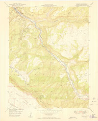
1949 Map of Uravan
USGS Topo · Published 1949About this map
Uravan and its surrounding canyonlands appear here at a pivotal moment in the mid-20th century, with the joint involvement of the United States Atomic Energy Commission signaling the area's industrial importance. The landscape is dominated by the deeply carved path of the San Miguel River, which serves as the primary geographic corridor for the local mining economy. Strategic extraction points such as the Club Mines, Black Dinah Mine, and Long Park No 6 Mine are scattered across the mesas, connected by a network of primitive roads and a prominent Truck Trail.
Find a feature on this map
32 named features on this map. Tap any name to fly to it.
Don’t see what you’re looking for? This feature index may not catch every label — zoom into the map to look around manually.
Map Details
Editions of this 1949 Uravan Map
2 editions found
Other maps of this area

1916 · Paradox Valley
USGS Topo · 1:125,000

1922 · Paradox Valley
USGS Topo · 1:125,000

1948 · Bull Canyon
USGS Topo · 1:24,000

1948 · Uravan
USGS Topo · 1:24,000

1948 · Naturita NW
USGS Topo · 1:24,000

1949 · Bull Canyon
USGS Topo · 1:24,000

1949 · Davis Mesa
USGS Topo · 1:24,000

1949 · Naturita NW
USGS Topo · 1:24,000

1949 · Atkinson Creek
USGS Topo · 1:24,000

1949 · Red Canyon
USGS Topo · 1:24,000