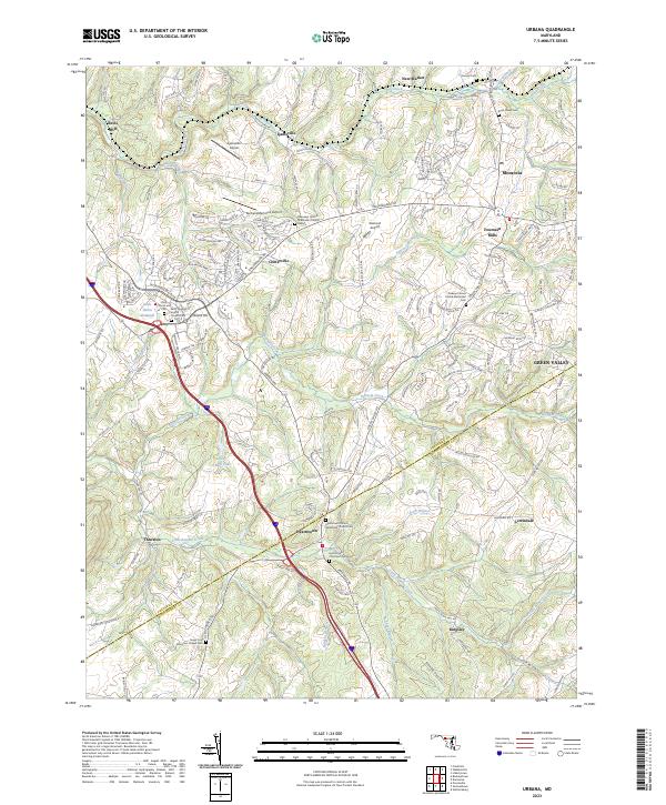
2023 Map of Urbana
USGS Topo · Published 2023About this map
Bennett Creek and its many tributaries, including Little Bennett Creek, define the rolling landscape of this Maryland corridor between Ijamsville and Hyattstown. The settlement pattern follows a network of historic roads such as Prices Distillery Rd and Fingerboard Rd, connecting long-standing communities like Monrovia and Fountain Mills. The intersection of modern development and heritage is evident in the numerous preserved ecclesiastical sites, including the Hyattstown United Methodist Church Cem and the Ebenezer United Methodist Church.
Find a feature on this map
151 named features on this map. Tap any name to fly to it.
Don’t see what you’re looking for? This feature index may not catch every label — zoom into the map to look around manually.
Map Details
Editions of this 2023 Urbana Map
This is the sole edition of this map. No revisions or reprints were ever made.
Other maps of this area

1893 · Frederick
USGS Topo · 1:125,000

1894 · Frederick
USGS Topo · 1:125,000

1908 · Rockville
USGS Topo · 1:62,500

1908 · Seneca
USGS Topo · 1:62,500

1908 · Ijamsville
USGS Topo · 1:62,500

1909 · Mount Airy
USGS Topo · 1:62,500

1909 · Ijamsville
USGS Topo · 1:62,500

1923 · Rockville
USGS Topo · 1:62,500

1942 · Frederick
USGS Topo · 1:62,500

1944 · Walkersville
USGS Topo · 1:31,680