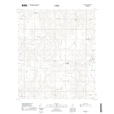
2018 Map of Uriah West
USGS Topo · Published 2018About this map
Uriah serves as the primary hub in this portion of Monroe County, situated where Cemetery St and Pecan St meet. The surrounding landscape is defined by a dense network of creek drainages including Butterfork Cr, Hurricane Br, and Beaverdam Cr, which carve through the terrain between small upland settlements like Palmers Crossroads and Jeddo. For those researching local families, the map identifies several significant burial sites, such as Morning Star Cem near Homewood and Semirah Springs Cem to the south. The rural infrastructure is visible through a complex system of named local roads like Doc Caylor Rd and Jim Snow Rd, illustrating the distribution of homesteads and agricultural land across the various sections of Township 4 and 5 North.
Find a feature on this map
62 named features on this map. Tap any name to fly to it.
Don’t see what you’re looking for? This feature index may not catch every label — zoom into the map to look around manually.
Map Details
Editions of this 2018 Uriah West Map
This is the sole edition of this map. No revisions or reprints were ever made.
Other maps of this area

1942 · Perdido
USGS Topo · 1:62,500

1944 · Perdido
USGS Topo · 1:62,500

1953 · Andalusia
USGS Topo · 1:250,000

1957 · Andalusia
USGS Topo · 1:250,000

1960 · Huxford
USGS Topo · 1:24,000

1972 · Frisco City
USGS Topo · 1:24,000

1972 · Uriah East
USGS Topo · 1:24,000

1972 · Chrysler
USGS Topo · 1:24,000

1972 · Uriah West
USGS Topo · 1:24,000

1972 · Flynns Lake
USGS Topo · 1:24,000