
1972 Map of Uriah West
USGS Topo · Published 1974About this map
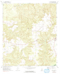
The southern portion of Monroe County and northern Escambia County are captured here in the early 1970s, showcasing a rural landscape defined by forestry and small agricultural hubs. The community of Uriah serves as a primary point of activity, connected to outlying settlements like Palmers Crossroads and Jeddo by a network of improved and secondary roads. The terrain is deeply carved by drainage systems, including Butterfork Creek and Hurricane Branch, which feed toward the Little River at the southern boundary.
Find a feature on this map
25 named features on this map. Tap any name to fly to it.
Don’t see what you’re looking for? This feature index may not catch every label — zoom into the map to look around manually.
Map Details
Editions of this 1972 Uriah West Map
2 editions found
Other maps of this area

1942 · Perdido
USGS Topo · 1:62,500

1944 · Perdido
USGS Topo · 1:62,500

1953 · Andalusia
USGS Topo · 1:250,000

1957 · Andalusia
USGS Topo · 1:250,000

1960 · Huxford
USGS Topo · 1:24,000

1972 · Frisco City
USGS Topo · 1:24,000

1972 · Uriah East
USGS Topo · 1:24,000

1972 · Chrysler
USGS Topo · 1:24,000

1972 · Flynns Lake
USGS Topo · 1:24,000

1972 · Gainestown
USGS Topo · 1:24,000