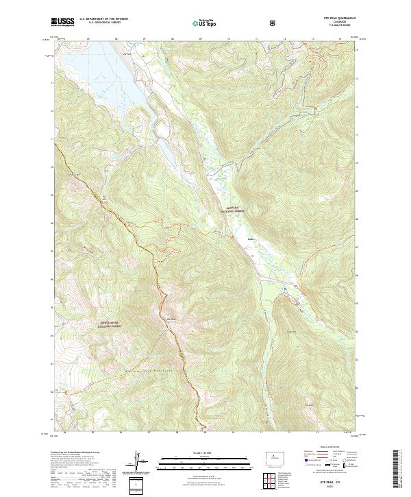
2022 Map of Ute Peak
USGS Topo · Published 2022About this map
The Williams Fork Mountains dominate this high-altitude landscape along the border of Grand and Summit Counties. This modern survey illustrates a rugged terrain defined by the complex drainage systems of the Williams Fork, including the MF Ranch Creek and Darling Cr which feed into the main valley. The small settlement of Leal sits centrally along the river, representing a long-standing gateway for travelers and forest workers in the Arapaho National Forest.
Find a feature on this map
42 named features on this map. Tap any name to fly to it.
Don’t see what you’re looking for? This feature index may not catch every label — zoom into the map to look around manually.
Map Details
Editions of this 2022 Ute Peak Map
This is the sole edition of this map. No revisions or reprints were ever made.
Other maps of this area

1924 · Montezuma
USGS Topo · 1:62,500

1924 · Fraser
USGS Topo · 1:62,500

1926 · Fraser
USGS Topo · 1:62,500

1926 · Montezuma
USGS Topo · 1:62,500

1929 · Dillon
USGS Topo · 1:62,500

1933 · Montezuma
USGS Topo · 1:62,500

1933 · Ute Peak
USGS Topo · 1:62,500

1934 · Dillon
USGS Topo · 1:62,500

1937 · Ute Peak
USGS Topo · 1:62,500

1953 · Denver
USGS Topo · 1:250,000