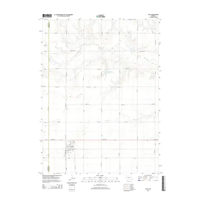
2014 Map of Utica
USGS Topo · Published 2014About this map
Utica sits at the intersection of Us-34 and Centennial Ave, serving as the primary hub for this agricultural landscape in eastern Nebraska. This 2014 survey illustrates a grid-like settlement pattern dominated by section roads and small watercourses, including the meandering Lincoln Cr and its tributaries like Wildcat Cr. Local history and genealogy are anchored by two distinct burial grounds: the Utica Cem located just north of the town limits and the Dewitt Cem to the northwest. The terrain is further defined by the Langenheim-Brackham Reservoir, a significant water feature amidst the surrounding fields. The road network, including historic routes like Old Mill Rd and Bluff Rd, reflects the enduring rural infrastructure of Seward County.
Find a feature on this map
30 named features on this map. Tap any name to fly to it.
Don’t see what you’re looking for? This feature index may not catch every label — zoom into the map to look around manually.
Map Details
Editions of this 2014 Utica Map
This is the sole edition of this map. No revisions or reprints were ever made.
Other maps of this area

1899 · David City
USGS Topo · 1:125,000

1934 · Seward
USGS Topo · 1:48,000

1934 · Utica
USGS Topo · 1:62,500

1937 · Utica
USGS Topo · 1:62,500

1939 · Seward
USGS Topo · 1:62,500

1955 · Fremont
USGS Topo · 1:250,000

1955 · Lincoln
USGS Topo · 1:250,000

1957 · Fremont
USGS Topo · 1:250,000

1957 · Lincoln
USGS Topo · 1:250,000

1958 · Fremont
USGS Topo · 1:250,000