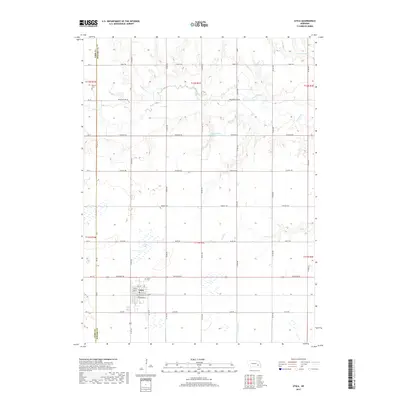
2017 Map of Utica
USGS Topo · Published 2017About this map
Agricultural patterns and drainage networks define this corner of Seward County, where the village of Utica serves as the primary local hub. The landscape is deeply etched by various tributaries including Wildcat Cr, Lincoln Cr, and Brush Cr, which feed into local catchments like the Langenheim-Brackhan Reservoir. This survey highlights the rigid Section-Line road grid characteristic of the Great Plains, featuring routes such as Davey Rd and McKelvie Rd that facilitate movement between farmsteads. For those looking into the area's heritage, the map identifies the Utica Cem near the town center and the isolated Dewitt Cem to the northwest. Small wetlands and bodies of water like North Lake are scattered throughout the sections, illustrating the local water management essential for the region's farming economy.
Find a feature on this map
25 named features on this map. Tap any name to fly to it.
Don’t see what you’re looking for? This feature index may not catch every label — zoom into the map to look around manually.
Map Details
Editions of this 2017 Utica Map
This is the sole edition of this map. No revisions or reprints were ever made.
Other maps of this area
1899 · David City
USGS Topo · 1:125,000
1934 · Seward
USGS Topo · 1:48,000
1934 · Utica
USGS Topo · 1:62,500
1937 · Utica
USGS Topo · 1:62,500
1939 · Seward
USGS Topo · 1:62,500
1955 · Fremont
USGS Topo · 1:250,000
1955 · Lincoln
USGS Topo · 1:250,000
1957 · Fremont
USGS Topo · 1:250,000
1957 · Lincoln
USGS Topo · 1:250,000
1958 · Fremont
USGS Topo · 1:250,000