
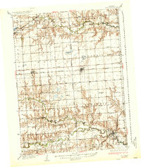
1937 Map of Utica
USGS Topo · Published 1937About this map
The agricultural landscape of eastern Nebraska is meticulously detailed here, centered on the village of Utica and the town of Thayer. This area, surveyed during the mid-1930s, reveals a dense network of rural infrastructure including over two dozen one-room schoolhouses like Sleepy Hollow Sch and Northfield Sch. The region is defined by the Chicago and Northwestern and Chicago Burlington and Quincy railroads, which facilitated the growth of these prairie communities. Local life is anchored by family-centered landmarks such as Prairie Grove Cem and St John Ch, while the terrain follows the winding path of Lincoln Creek and the West Fork Big Blue River. The presence of the Sixth Principal Meridian highlights the importance of early surveying and land division in the township system of Stewart and West Blue.
Find a feature on this map
49 named features on this map. Tap any name to fly to it.
Don’t see what you’re looking for? This feature index may not catch every label — zoom into the map to look around manually.
Map Details
Editions of this 1937 Utica Map
2 editions found
Other maps of this area

1896 · Stromsburg
USGS Topo · 1:125,000

1898 · York
USGS Topo · 1:125,000

1899 · David City
USGS Topo · 1:125,000

1899 · York
USGS Topo · 1:125,000

1934 · Seward
USGS Topo · 1:48,000

1934 · Utica
USGS Topo · 1:62,500

1935 · Dorchester
USGS Topo · 1:48,000

1939 · Seward
USGS Topo · 1:62,500

1940 · Dorchester
USGS Topo · 1:62,500

1955 · Fremont
USGS Topo · 1:250,000