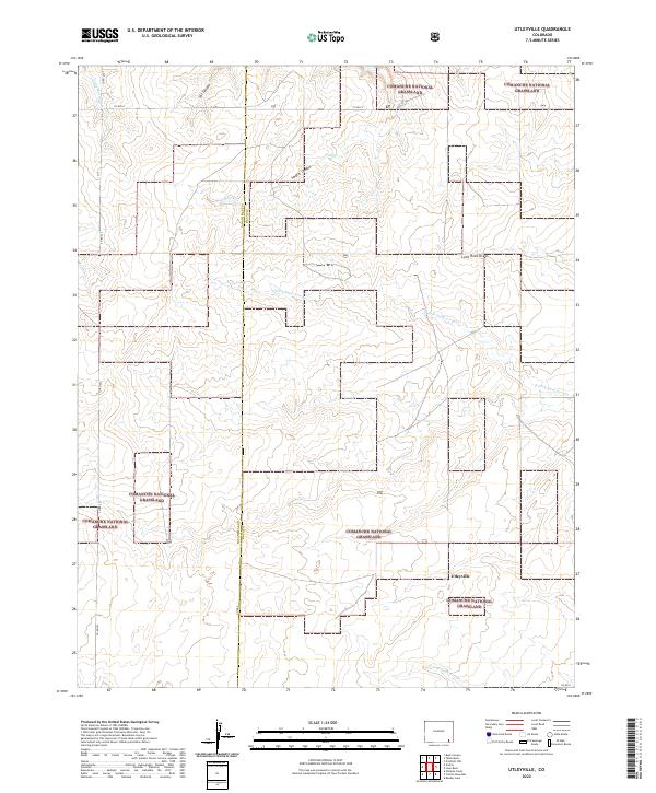
2022 Map of Utleyville
USGS Topo · Published 2022About this map
Utleyville stands as a focal point in this remote corner of southeastern Colorado, where the high plains meet deep-cut drainages. The landscape is defined by the expansive Comanche National Grassland, which preserves a distinct prairie ecosystem across the Baca and Las Animas county line. This survey captures a terrain carved by intermittent water, featuring prominent geological formations like Cat Canyon, Soldier Canyon, and the appropriately named Lone Rock Draw. A network of seasonal waterways, including the N Fork Sand Arroyo and S Fork Sand Arroyo, dictates the local topography and historical movement through the region. The map also delineates the precise boundary between Las Animas and Baca counties, following a grid of section lines and rural routes such as Co RD 223 and Co RD CC.
Find a feature on this map
19 named features on this map. Tap any name to fly to it.
Don’t see what you’re looking for? This feature index may not catch every label — zoom into the map to look around manually.
Map Details
Editions of this 2022 Utleyville Map
This is the sole edition of this map. No revisions or reprints were ever made.
Other maps of this area

1891 · Springfield
USGS Topo · 1:125,000

1892 · Mt Carrizo
USGS Topo · 1:125,000

1893 · Springfield
USGS Topo · 1:125,000

1955 · La Junta
USGS Topo · 1:250,000

1958 · La Junta
USGS Topo · 1:250,000

1968 · La Junta
USGS Topo · 1:250,000

1978 · Pintada Creek
USGS Topo · 1:24,000

1978 · Utleyville
USGS Topo · 1:24,000
1978 · Lone Rock
USGS Topo · 1:24,000
1978 · Pritchett NW
USGS Topo · 1:24,000