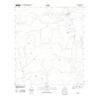
2010 Map of Utopia
USGS Topo · Published 2010About this map
Utopia and the nearby community of Waresville anchor this Hill Country landscape along the banks of the Sabinal River. The settlement pattern reflects the area's transition from early pioneer outposts to a modern rural community, centered around landmarks like the Utopia Park Lake Dam and the Waresville Cemetery. The terrain is characterized by a high density of named drainage features, including Onion Creek, Blanco Creek, and numerous family-named canyons such as Lynn Hollow, Grape Hollow, and Anton Hollow. The presence of the Utopia on the River Airport and La Jita Camp points to the region's 21st-century role in recreation and aviation. Further west, the topography rises toward Bald Mountain, while local operations like the Blanco Ranch illustrate the enduring ranching tradition of Uvalde County.
Find a feature on this map
40 named features on this map. Tap any name to fly to it.
Don’t see what you’re looking for? This feature index may not catch every label — zoom into the map to look around manually.
Map Details
Editions of this 2010 Utopia Map
This is the sole edition of this map. No revisions or reprints were ever made.
Other maps of this area

1898 · Uvalde
USGS Topo · 1:125,000

1899 · Uvalde
USGS Topo · 1:125,000

1954 · San Antonio
USGS Topo · 1:250,000

1956 · Sabinal
USGS Topo · 1:62,500

1956 · Tarpley
USGS Topo · 1:62,500

1956 · Utopia
USGS Topo · 1:62,500

1957 · San Antonio
USGS Topo · 1:250,000

1960 · Concan
USGS Topo · 1:24,000

1960 · Magers Crossing
USGS Topo · 1:24,000
1964 · Seco Pass
USGS Topo · 1:24,000