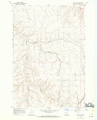
1968 Map of Utts Butte
USGS Topo · Published 1970About this map
Utts Butte anchors this high-desert plateau in Morrow County, where a complex network of deeply incised drainage systems defines the landscape. The geography is dominated by a series of parallel canyons, including Eightmile Canyon, Jordan Canyon, and Kincaid Canyon, which carve through the volcanic soils towards the Willow Creek basin in the north. This 1960s survey documents a rural economy tied to dryland farming and livestock, evidenced by scattered infrastructure like the Grain Elevator and various Storage Bins.
Find a feature on this map
23 named features on this map. Tap any name to fly to it.
Don’t see what you’re looking for? This feature index may not catch every label — zoom into the map to look around manually.
Map Details
Editions of this 1968 Utts Butte Map
This is the sole edition of this map. No revisions or reprints were ever made.
Other maps of this area

1906 · Blalock Island
USGS Topo · 1:125,000

1908 · Blalock Island
USGS Topo · 1:125,000

1916 · Arlington
USGS Topo · 1:125,000

1916 · Condon
USGS Topo · 1:125,000

1953 · Pendleton
USGS Topo · 1:250,000

1953 · The Dalles
USGS Topo · 1:250,000

1956 · The Dalles
USGS Topo · 1:250,000

1956 · Pendleton
USGS Topo · 1:250,000

1957 · The Dalles
USGS Topo · 1:250,000

1964 · Hickland Butte
USGS Topo · 1:24,000