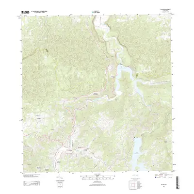
2013 Map of Utuado
USGS Topo · Published 2013About this map
The town of Utuado serves as the central hub of this inland landscape, situated at the confluence of the Río Viví and the Río Grande de Arecibo. The map details the complex hydraulic geography of the region, anchored by the significant reservoirs of Lago Dos Bocas and Lago Caonillas. These water bodies dominate the central and eastern sections, fed by numerous tributaries such as Quebrada Júa and Río Caonillas.
Find a feature on this map
33 named features on this map. Tap any name to fly to it.
Don’t see what you’re looking for? This feature index may not catch every label — zoom into the map to look around manually.
Map Details
Editions of this 2013 Utuado Map
This is the sole edition of this map. No revisions or reprints were ever made.
Other maps of this area

1938 · Camuy
USGS Topo · 1:20,000

1942 · Arecibo
USGS Topo · 1:30,000

1942 · Camuy
USGS Topo · 1:30,000

1942 · Barceloneta
USGS Topo · 1:30,000

1943 · Utuado NE
USGS Topo · 1:10,000

1946 · Barceloneta
USGS Topo · 1:30,000

1946 · Utuado
USGS Topo · 1:30,000

1946 · Bayaney
USGS Topo · 1:30,000

1946 · Jayuya
USGS Topo · 1:30,000

1946 · Monte Guilarte
USGS Topo · 1:30,000