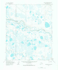
1955 Map of Utukok River D-5
USGS Topo · Published 1966About this map
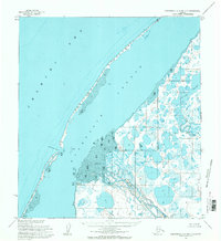
The Utukok River dominates this Arctic landscape, winding through a complex network of thaw lakes and wetlands on Alaska's North Slope. Mapped by the Army Map Service during the mid-1950s, the terrain is defined by its water-saturated tundra and a series of oxbow lakes left behind by the river's shifting path. The northern edge of the map features the Avak River, while the western portion is marked by the Naval Petroleum Reserve No 4 Boundary, reflecting the strategic importance of this region's resources during the Cold War. Movement across this trackless wilderness is limited to a solitary Trail and a Tractor Trail in the northeast, highlighting the extreme isolation and the specific methods of transport required to navigate the permafrost environment before more permanent infrastructure existed.
Find a feature on this map
6 named features on this map. Tap any name to fly to it.
Don’t see what you’re looking for? This feature index may not catch every label — zoom into the map to look around manually.
Map Details
Editions of this 1955 Utukok River D-5 Map
This is the sole edition of this map. No revisions or reprints were ever made.
Other maps of this area

1951 · Utukok River
USGS Topo · 1:250,000

1951 · Wainwright
USGS Topo · 1:250,000

1951 · Point Lay
USGS Topo · 1:250,000

1955 · Wainwright
USGS Topo · 1:250,000

1955 · Point Lay
USGS Topo · 1:250,000
1955 · Utukok River D-4
USGS Topo · 1:63,360
1955 · Utukok River C-5
USGS Topo · 1:63,360

1955 · Point Lay C-1
USGS Topo · 1:63,360
1955 · Utukok River C-4
USGS Topo · 1:63,360
1955 · Wainwright A-6 and A-7
USGS Topo · 1:63,360