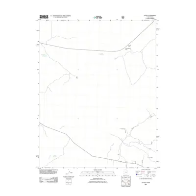
2011 Map of Uvada
USGS Topo · Published 2011About this map
Uvada sits along a primary rail and road corridor crossing the high desert near the state line, serving as a focal point for the surrounding rangeland. This 2011 survey highlights a network of water management features essential for the arid climate, including Old Highway Reservoir, Uvada Reservoir, and Lafes Reservoir. The drainage patterns of Clover Creek and Lien Draw shape the basin, while significant terrain breaks like Devils Gap and Sheep Spring Draw provide natural landmarks for travelers and ranchers alike.
Find a feature on this map
10 named features on this map. Tap any name to fly to it.
Don’t see what you’re looking for? This feature index may not catch every label — zoom into the map to look around manually.
Map Details
Editions of this 2011 Uvada Map
This is the sole edition of this map. No revisions or reprints were ever made.
Other maps of this area

1885 · St. George
USGS Topo · 1:250,000

1885 · Pioche
USGS Topo · 1:250,000

1886 · Pioche
USGS Topo · 1:250,000

1891 · St. George
USGS Topo · 1:250,000

1953 · Cedar City
USGS Topo · 1:250,000

1954 · Caliente
USGS Topo · 1:250,000

1958 · Cedar City
USGS Topo · 1:250,000

1959 · Caliente
USGS Topo · 1:250,000

1962 · Cedar City
USGS Topo · 1:250,000
1972 · Panaca Summit
USGS Topo · 1:24,000