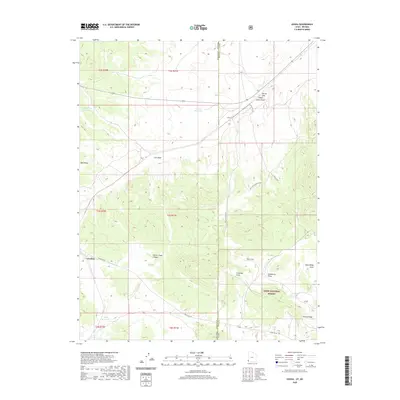
2020 Map of Uvada
USGS Topo · Published 2020About this map
Uvada and Crestline occupy a remote rail and ranching corridor along the state line between Lincoln County, Nevada, and Iron County, Utah. This high-desert landscape is defined by the drainage systems of Clover Creek Canyon and Salt Lick Canyon, where water management is critical as seen in Uvada Reservoir, Old Highway Reservoir, and Lafes Reservoir. The eastern edge of the map transitions into the timbered terrain of the Dixie National Forest, while the southwestern section is anchored by the prominent Panaca Ridge. Local transportation and livestock movements are traced through features like the Salt Lick Canyon Cutoff, Crestline Rd, and the Uvada RR Xing. Distinctive landmarks such as Devils Gap and the Salt Licks provide essential navigation points in this arid topography.
Find a feature on this map
29 named features on this map. Tap any name to fly to it.
Don’t see what you’re looking for? This feature index may not catch every label — zoom into the map to look around manually.
Map Details
Editions of this 2020 Uvada Map
This is the sole edition of this map. No revisions or reprints were ever made.
Other maps of this area

1885 · St. George
USGS Topo · 1:250,000

1885 · Pioche
USGS Topo · 1:250,000

1886 · Pioche
USGS Topo · 1:250,000

1891 · St. George
USGS Topo · 1:250,000

1953 · Cedar City
USGS Topo · 1:250,000

1954 · Caliente
USGS Topo · 1:250,000

1958 · Cedar City
USGS Topo · 1:250,000

1959 · Caliente
USGS Topo · 1:250,000

1962 · Cedar City
USGS Topo · 1:250,000
1972 · Panaca Summit
USGS Topo · 1:24,000