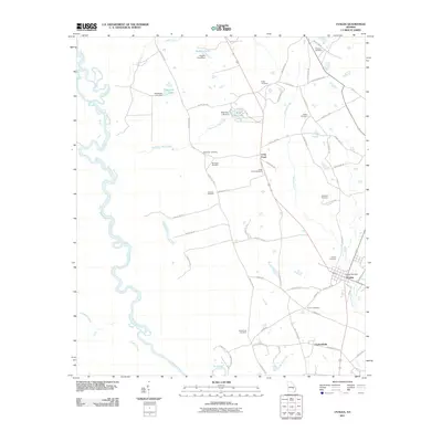
2011 Map of Uvalda
USGS Topo · Published 2011About this map
The Oconee River carves a complex, winding path through this corner of Montgomery County, defining the western landscape with its oxbows and marshy banks. Settlement is anchored by the community of Uvalda, where the Uvalda Post Office serves as a central landmark at the intersection of local routes. To the south, Charlotteville marks another point of habitation, linked to the surrounding countryside by an extensive network of county roads.
Find a feature on this map
65 named features on this map. Tap any name to fly to it.
Don’t see what you’re looking for? This feature index may not catch every label — zoom into the map to look around manually.
Map Details
Editions of this 2011 Uvalda Map
This is the sole edition of this map. No revisions or reprints were ever made.
Other maps of this area

1953 · Waycross
USGS Topo · 1:250,000

1957 · Macon
USGS Topo · 1:250,000

1958 · Macon
USGS Topo · 1:250,000

1958 · Waycross
USGS Topo · 1:250,000

1964 · Macon
USGS Topo · 1:250,000

1970 · Glenwood
USGS Topo · 1:24,000

1970 · Alston
USGS Topo · 1:24,000

1970 · Mount Vernon
USGS Topo · 1:24,000

1970 · Vidalia
USGS Topo · 1:24,000

1970 · Uvalda
USGS Topo · 1:24,000