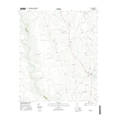
2017 Map of Uvalda
USGS Topo · Published 2017About this map
The Oconee River defines the western boundary of this territory, where the borders of Montgomery and Wheeler counties meet amidst a sprawling network of wetlands and river bends. The landscape is marked by a history of water-powered industry and rural settlement, evidenced by features such as McAllister Mill Cr and Mobley Mill Cr. The town of Uvalda sits at the junction of several local routes, serving as a central hub for the surrounding timber and agricultural lands. To the south lies Charlotteville, another established community near the banks of the Dead River. Scattered throughout the quadrangle are numerous family and community burial grounds, including McAllister Cem, Walker Cem, and the Old Salem Cem, which provide essential points of reference for genealogists tracing the legacy of the families who settled this part of Georgia along Long Pond.
Find a feature on this map
85 named features on this map. Tap any name to fly to it.
Don’t see what you’re looking for? This feature index may not catch every label — zoom into the map to look around manually.
Map Details
Editions of this 2017 Uvalda Map
This is the sole edition of this map. No revisions or reprints were ever made.
Other maps of this area

1953 · Waycross
USGS Topo · 1:250,000

1957 · Macon
USGS Topo · 1:250,000

1958 · Macon
USGS Topo · 1:250,000

1958 · Waycross
USGS Topo · 1:250,000

1964 · Macon
USGS Topo · 1:250,000

1970 · Glenwood
USGS Topo · 1:24,000

1970 · Alston
USGS Topo · 1:24,000

1970 · Mount Vernon
USGS Topo · 1:24,000

1970 · Vidalia
USGS Topo · 1:24,000

1970 · Uvalda
USGS Topo · 1:24,000