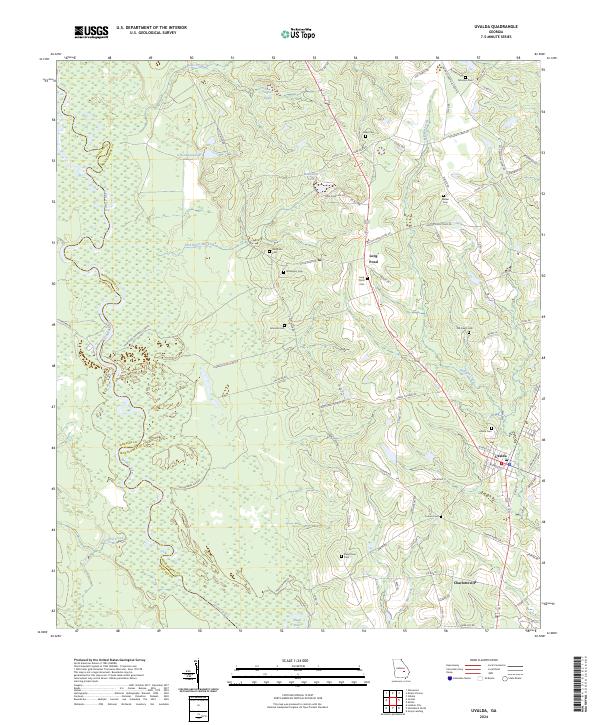
2024 Map of Uvalda
USGS Topo · Published 2024About this map
The Oconee River carves a winding path through the western half of this landscape, defining the boundary between Wheeler and Montgomery counties. The town of Uvalda serves as a primary hub in the east, situated near the intersection of several local routes such as Green Thigpen Rd. To the south, the smaller community of Charlotteville lies along the rail line, while the surrounding countryside is dotted with family-named landmarks and cemeteries like McAllister Cem and Walker Cem.
Find a feature on this map
85 named features on this map. Tap any name to fly to it.
Don’t see what you’re looking for? This feature index may not catch every label — zoom into the map to look around manually.
Map Details
Editions of this 2024 Uvalda Map
This is the sole edition of this map. No revisions or reprints were ever made.
Other maps of this area

1953 · Waycross
USGS Topo · 1:250,000

1957 · Macon
USGS Topo · 1:250,000

1958 · Macon
USGS Topo · 1:250,000

1958 · Waycross
USGS Topo · 1:250,000

1964 · Macon
USGS Topo · 1:250,000

1970 · Glenwood
USGS Topo · 1:24,000

1970 · Alston
USGS Topo · 1:24,000

1970 · Mount Vernon
USGS Topo · 1:24,000

1970 · Vidalia
USGS Topo · 1:24,000

1970 · Uvalda
USGS Topo · 1:24,000