Loading...
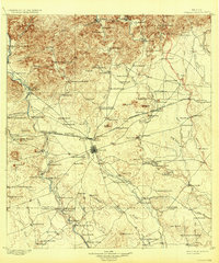
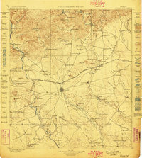
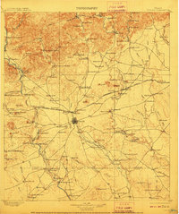
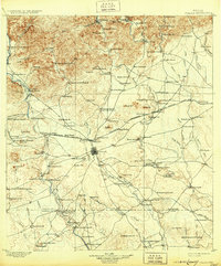
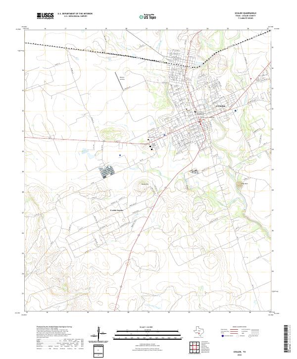
Loading map...1898 Map of Uvalde
USGS Topo · Published 1931About this map
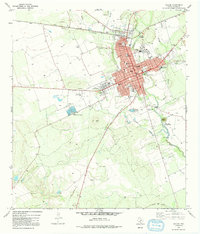
Uvalde serves as the central hub of this late 19th-century landscape, situated where the Southern Pacific railroad cuts through a terrain defined by river sloughs and rising ridges. The settlement pattern is dominated by a sprawling network of family-held properties such as the Bucklew Ranch, Kincaid Ranch, and Mc Daniels Ranch, reflecting a cattle-country economy reliant on the scattered Windmill sites and waterholes like Eightmile Waterhole that sustain life in the drier reaches of the Nueces River valley.
Find a feature on this map
121 named features on this map. Tap any name to fly to it.
Don’t see what you’re looking for? This feature index may not catch every label — zoom into the map to look around manually.
Map Details
Date Portrayed1898
Date Published1931
PublisherU.S. Geological Survey
Map TypeTopographic
Scale1:125,000
Physical Dimensions16.4 x 19.7 inches
Editions of this 1898 Uvalde Map
3 editions found
Historical Maps of Uvalde Through Time
10 maps found
Featured Locations
Source Details
SourceU.S. Geological Survey
CopyrightPublic Domain