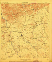
1898 Map of Uvalde
USGS Topo · Published 1910About this map
Uvalde serves as the central hub of this South Texas landscape, where the Southern Pacific railroad meets a sprawling network of family-operated cattle and goat ranches. Surveyed in 1896, the map reveals a transition from the limestone breaks of the Edwards Plateau to the flatter brush country, with the Frio River and Nueces River providing essential water sources. Settled outposts like Concan and Sansom P.O. are surrounded by prominent landmarks like Chalk Bluff and Inge Mt., illustrating the early regional geography before modern infrastructure took hold.
Find a feature on this map
129 named features on this map. Tap any name to fly to it.
Don’t see what you’re looking for? This feature index may not catch every label — zoom into the map to look around manually.
Map Details
Editions of this 1898 Uvalde Map
3 editions found
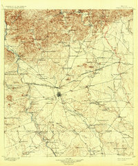
Other maps of this area

1893 · Nueces
USGS Topo · 1:125,000

1896 · Nueces
USGS Topo · 1:125,000

1896 · Brackett
USGS Topo · 1:125,000

1897 · Brackett
USGS Topo · 1:125,000

1898 · Uvalde
USGS Topo · 1:125,000

1899 · Uvalde
USGS Topo · 1:125,000

1928 · Frio Town
USGS Topo · 1:62,500

1938 · Turkey Mountain
USGS Topo · 1:48,000

1939 · La Pryor
USGS Topo · 1:62,500

1940 · Chacon Creek
USGS Topo · 1:62,500