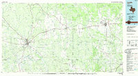
1985 Map of Uvalde
USGS Topo · Published 1985About this map
The Nueces River and its major tributaries, including the Frio River and Sabinal River, define the landscape of this South Texas region in the mid-1980s. The city of Uvalde serves as a central hub where the Southern Pacific and Missouri Pacific railroads converge, supporting the local agricultural and ranching economy. Significant landmarks such as the Uvalde National Fish Hatchery and the Junior College reflect the institutional development of the county seat, while the Taylor Ina Oil Field to the east indicates the area's industrial footprint.
Find a feature on this map
59 named features on this map. Tap any name to fly to it.
Don’t see what you’re looking for? This feature index may not catch every label — zoom into the map to look around manually.
Map Details
Editions of this 1985 Uvalde Map
This is the sole edition of this map. No revisions or reprints were ever made.
Other maps of this area

1893 · Nueces
USGS Topo · 1:125,000

1896 · Nueces
USGS Topo · 1:125,000

1896 · Brackett
USGS Topo · 1:125,000

1897 · Brackett
USGS Topo · 1:125,000

1898 · Uvalde
USGS Topo · 1:125,000

1899 · Uvalde
USGS Topo · 1:125,000

1925 · Pearsall 1-b
USGS Topo · 1:48,000

1927 · Pearsall
USGS Topo · 1:62,500

1928 · Frio Town
USGS Topo · 1:62,500

1934 · Schattel
USGS Topo · 1:62,500