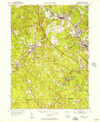
1953 Map of Uxbridge
USGS Topo · Published 1957About this map
Industrial hubs and agricultural pockets define this mid-century landscape along the Blackstone River valley. The map documents a complex water-management system supporting regional industry, featuring numerous impoundments like Rice City Pond, Whitins Pond, and Arcade Pond. To the east, the historic Blackstone Canal traces the river corridor through North Uxbridge and Linwood, while the New York New Haven and Hartford railroad cuts a diagonal path through the dense terrain of Douglas.
Find a feature on this map
93 named features on this map. Tap any name to fly to it.
Don’t see what you’re looking for? This feature index may not catch every label — zoom into the map to look around manually.
Map Details
Editions of this 1953 Uxbridge Map
3 editions found
Other maps of this area

1886 · Blackstone
USGS Topo · 1:62,500

1889 · Blackstone
USGS Topo · 1:62,500

1889 · Webster
USGS Topo · 1:62,500

1889 · Putnam
USGS Topo · 1:62,500

1889 · Burrillville
USGS Topo · 1:62,500

1892 · Webster
USGS Topo · 1:62,500

1893 · Putnam
USGS Topo · 1:62,500

1893 · Blackstone
USGS Topo · 1:62,500

1894 · Burrillville
USGS Topo · 1:62,500

1900 · Blackstone
USGS Topo · 1:62,500