
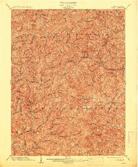
1904 Map of Vadis
USGS Topo · Published 1904About this map
The rolling hills of Lewis and Doddridge counties define this turn-of-the-century landscape, centered on the village of Vadis. The settlement pattern is dictated by the intricate drainage networks of Fink Creek and Leading Creek, where small communities like Alum Bridge and Hurst took root at critical junctions. In the northern reaches, the map records established crossroads and post offices such as New Milton and Big Isaac, reflecting a rural economy built around these creek-valley corridors. The terrain is notably dissected, punctuated by landmarks like the prominent Sugarloaf peak. Political and land boundaries are precisely marked, including the Harrison Co Lewis Co line and the Doddridge Co Lewis Co border, providing essential data for genealogists tracing ancestral property in these West Virginia highlands before the development of modern highway systems.
Find a feature on this map
81 named features on this map. Tap any name to fly to it.
Don’t see what you’re looking for? This feature index may not catch every label — zoom into the map to look around manually.
Map Details
Editions of this 1904 Vadis Map
2 editions found
Other maps of this area

1893 · Buckhannon
USGS Topo · 1:125,000

1893 · Sutton
USGS Topo · 1:125,000

1896 · Buckhannon
USGS Topo · 1:125,000

1897 · Buckhannon
USGS Topo · 1:125,000

1902 · Clarksburg
USGS Topo · 1:62,500

1904 · Weston
USGS Topo · 1:62,500

1905 · Centerpoint
USGS Topo · 1:62,500

1905 · West Union
USGS Topo · 1:62,500

1906 · Holbrook
USGS Topo · 1:62,500

1906 · Glenville
USGS Topo · 1:62,500