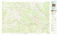
1980 Map of Vail
USGS Topo · Published 1982About this map
The Eagle River and Colorado River define the high-country landscape of this 1980 survey, where the Denver and Rio Grande Western railroad tracks follow the river bends past historic mountain communities. This era captures the transition of the region into a premier recreational destination, with Interstate 70 threading through Vail, Avon, and Edwards. Industry remains visible in the landscape through sites like the Lady Belle Mine and Johnson Mine near Gilman and Red Cliff. To the east, the Gore Range separates the Eagle valley from the Williams Fork Mountains, where the Green Mountain Reservoir and Dillon Reservoir dominate the hydrologic map. The presence of the Eagle County Airport at Gypsum reflects the growing logistical needs of these once-isolated valley settlements as they became interconnected hubs.
Find a feature on this map
62 named features on this map. Tap any name to fly to it.
Don’t see what you’re looking for? This feature index may not catch every label — zoom into the map to look around manually.
Map Details
Editions of this 1980 Vail Map
This is the sole edition of this map. No revisions or reprints were ever made.
Other maps of this area

1889 · Leadville
USGS Topo · 1:125,000

1891 · Leadville
USGS Topo · 1:125,000

1909 · Mount Jackson
USGS Topo · 1:125,000

1911 · Mount Jackson
USGS Topo · 1:125,000

1915 · Longs Peak
USGS Topo · 1:125,000

1919 · Rocky Mountain National Park
USGS Topo · 1:125,000

1924 · Montezuma
USGS Topo · 1:62,500

1924 · Fraser
USGS Topo · 1:62,500

1926 · Fraser
USGS Topo · 1:62,500

1926 · Montezuma
USGS Topo · 1:62,500