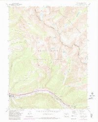
1970 Map of Vail East
USGS Topo · Published 1983About this map
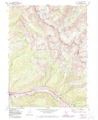
Gore Creek flows through the southern corridor of this high-altitude landscape, marking the early expansion of Vail as it began its transformation into a major destination. The development of the Gore Golf Course and the settlement at Bighorn contrast with the primitive alpine wilderness of the Gore Range immediately to the north. A network of high-country access routes, including the Booth Pack Trail and Pitkin Pack Trail, leads upward from the valley floor toward glacial features like Booth Lake and Pitkin Lake. The map illustrates the convergence of recreational development and protected wilderness, split between the Arapaho National Forest and White River National Forest, during a period of significant growth for the Eagle County resort community.
Find a feature on this map
37 named features on this map. Tap any name to fly to it.
Don’t see what you’re looking for? This feature index may not catch every label — zoom into the map to look around manually.
Map Details
Editions of this 1970 Vail East Map
5 editions found
Other maps of this area

1929 · Dillon
USGS Topo · 1:62,500

1933 · Mt. Powell
USGS Topo · 1:48,000

1933 · Ute Peak
USGS Topo · 1:62,500

1934 · Minturn
USGS Topo · 1:62,500

1934 · Dillon
USGS Topo · 1:62,500

1937 · Ute Peak
USGS Topo · 1:62,500

1940 · Mount Powell
USGS Topo · 1:62,500

1950 · Minturn
USGS Topo · 1:62,500

1957 · Leadville
USGS Topo · 1:250,000

1959 · Leadville
USGS Topo · 1:250,000