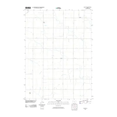
2010 Map of Vail NE
USGS Topo · Published 2010About this map
Emmanuel Cemetery, South Wall Lake Cemetery, and Wheatland Cemetery anchor this rural landscape in Carroll County, reflecting the deep-rooted agricultural settlement patterns of western Iowa. The terrain is defined by the drainage of the Middle Raccoon River and its tributaries, including Lime Creek and Beamon Creek, which cut through a strict grid of section roads. The presence of the Lawler Landing Strip in the southwest corner suggests the intersection of traditional farming with modern aviation infrastructure. This 2010 survey provides a clear view of the section lines and local thoroughfares like Needham Ave and Birch Ave that have guided movement through these townships for generations.
Find a feature on this map
32 named features on this map. Tap any name to fly to it.
Don’t see what you’re looking for? This feature index may not catch every label — zoom into the map to look around manually.
Map Details
Editions of this 2010 Vail NE Map
This is the sole edition of this map. No revisions or reprints were ever made.
Other maps of this area

1954 · Fort Dodge
USGS Topo · 1:250,000

1957 · Fort Dodge
USGS Topo · 1:250,000

1958 · Fort Dodge
USGS Topo · 1:250,000

1980 · Odebolt East
USGS Topo · 1:24,000

1980 · Breda
USGS Topo · 1:24,000

1980 · Grant City
USGS Topo · 1:24,000

1980 · Lake View
USGS Topo · 1:24,000

1980 · Boyer
USGS Topo · 1:24,000
1980 · Carroll West
USGS Topo · 1:24,000
1980 · Vail NE
USGS Topo · 1:24,000