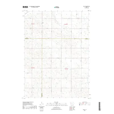
2018 Map of Vail NE
USGS Topo · Published 2018About this map
Carroll County farm country at the intersection of Crawford and Sac counties is defined by its deep agricultural grid and the winding passage of the Middle Raccoon River. This landscape is primarily organized by section lines and gravel routes such as Co Hwy E16 and Co Rd E26, which cut through the undulating terrain of the Raccoon River valley. These roads connect the dispersed farmsteads that have sustained this region for generations.
Find a feature on this map
28 named features on this map. Tap any name to fly to it.
Don’t see what you’re looking for? This feature index may not catch every label — zoom into the map to look around manually.
Map Details
Editions of this 2018 Vail NE Map
This is the sole edition of this map. No revisions or reprints were ever made.
Other maps of this area

1954 · Fort Dodge
USGS Topo · 1:250,000

1957 · Fort Dodge
USGS Topo · 1:250,000

1958 · Fort Dodge
USGS Topo · 1:250,000

1980 · Odebolt East
USGS Topo · 1:24,000

1980 · Breda
USGS Topo · 1:24,000

1980 · Grant City
USGS Topo · 1:24,000

1980 · Lake View
USGS Topo · 1:24,000

1980 · Boyer
USGS Topo · 1:24,000
1980 · Carroll West
USGS Topo · 1:24,000
1980 · Vail NE
USGS Topo · 1:24,000