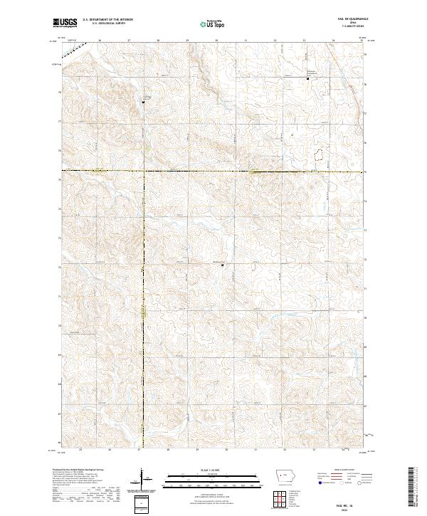
2022 Map of Vail NE
USGS Topo · Published 2022About this map
The Middle Raccoon River winds through the southeastern corner of this landscape, marking a terrain defined by the intersection of Carroll, Crawford, and Sac counties. This western Iowa region is characterized by a high concentration of drainage features including the Wall Lake Inlet, Lime Cr, and Beamon Cr. The land is organized by a precise grid of rural roads such as Mace Ave and Eagle Ave, which connect several significant community landmarks. Genealogists and local historians will find the locations of Immanuel Presbyterian Cem, Wheatland Cem, and South Wall Lake Cem particularly useful for tracing early families in the area. Modern recreational development is also evident along the Sauk Rail Trl, which follows a former railway corridor in the northeast, providing a clear example of how historical transportation infrastructure has been repurposed for current use.
Find a feature on this map
40 named features on this map. Tap any name to fly to it.
Don’t see what you’re looking for? This feature index may not catch every label — zoom into the map to look around manually.
Map Details
Editions of this 2022 Vail NE Map
This is the sole edition of this map. No revisions or reprints were ever made.
Other maps of this area

1954 · Fort Dodge
USGS Topo · 1:250,000

1957 · Fort Dodge
USGS Topo · 1:250,000

1958 · Fort Dodge
USGS Topo · 1:250,000

1980 · Odebolt East
USGS Topo · 1:24,000

1980 · Breda
USGS Topo · 1:24,000

1980 · Grant City
USGS Topo · 1:24,000

1980 · Lake View
USGS Topo · 1:24,000

1980 · Boyer
USGS Topo · 1:24,000
1980 · Carroll West
USGS Topo · 1:24,000
1980 · Vail NE
USGS Topo · 1:24,000