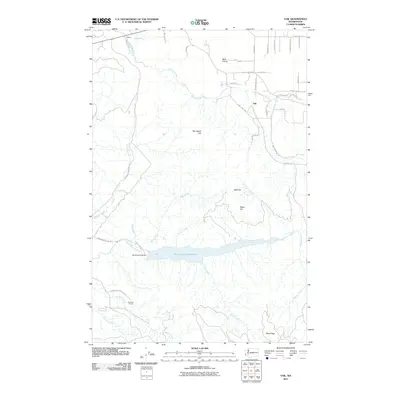
2011 Map of Vail
USGS Topo · Published 2011About this map
The Skookumchuck Reservoir dominates the central landscape of this Thurston County region, created by the engineering of the Skookumchuck Dam. To the north, the settlement of Vail serves as a focal point near the winding Deschutes River, surrounded by a network of rural roads such as Vail Loop SE and Gordon Rd SE. The terrain is defined by significant elevations including Baumgard Hill and Blue Ridge, which separate the various drainage basins of the area. Notable watercourses like Bloody Run and Turvey Creek feed into the larger river systems, illustrating a complex hydrological environment. This survey captures a rural Washington landscape characterized by isolated homesteads like Sundown Ranch and the open spaces of Ruth Prairie, reflecting the timber and agricultural character of the Pacific Northwest in the early 21st century.
Find a feature on this map
42 named features on this map. Tap any name to fly to it.
Don’t see what you’re looking for? This feature index may not catch every label — zoom into the map to look around manually.
Map Details
Editions of this 2011 Vail Map
This is the sole edition of this map. No revisions or reprints were ever made.
Other maps of this area

1916 · Chehalis
USGS Topo · 1:125,000

1940 · Tenino
USGS Topo · 1:62,500

1943 · Willapa
USGS Topo · 1:62,500

1944 · Tenino
USGS Topo · 1:62,500

1944 · Yelm
USGS Topo · 1:62,500

1949 · Yelm
USGS Topo · 1:62,500

1949 · Tenino
USGS Topo · 1:62,500

1953 · Hoquiam
USGS Topo · 1:250,000

1954 · Onalaska
USGS Topo · 1:62,500

1954 · Centralia
USGS Topo · 1:62,500