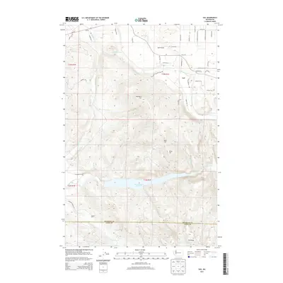
2013 Map of Vail
USGS Topo · Published 2013About this map
The settlement of Vail sits at the junction of several rural routes in this 2013 survey of the southern Puget Sound backcountry. The landscape is defined by the significant hydrological divide between the Deschutes River, which flows through the northern half of the quadrangle past Ruth Prairie, and the Skookumchuck River to the south. The massive Skookumchuck Reservoir dominates the central terrain, its waters held back by elevations including Baumgard Hill and Miller Hill. Local naming conventions hint at a pioneer history, with features like Bloody Run, Troller Run, and Blue Ridge marking the varied topography. The map also delineates the jurisdictional boundary where Thurston Co meets Lewis Co, crossing near the Sundown Ranch. Residential development is concentrated in small pockets like Wetica and the estates near McIntosh Valley Ln SE, contrasting with the surrounding timberlands and river valleys.
Find a feature on this map
52 named features on this map. Tap any name to fly to it.
Don’t see what you’re looking for? This feature index may not catch every label — zoom into the map to look around manually.
Map Details
Editions of this 2013 Vail Map
This is the sole edition of this map. No revisions or reprints were ever made.
Other maps of this area

1916 · Chehalis
USGS Topo · 1:125,000

1940 · Tenino
USGS Topo · 1:62,500

1943 · Willapa
USGS Topo · 1:62,500

1944 · Tenino
USGS Topo · 1:62,500

1944 · Yelm
USGS Topo · 1:62,500

1949 · Yelm
USGS Topo · 1:62,500

1949 · Tenino
USGS Topo · 1:62,500

1953 · Hoquiam
USGS Topo · 1:250,000

1954 · Onalaska
USGS Topo · 1:62,500

1954 · Centralia
USGS Topo · 1:62,500