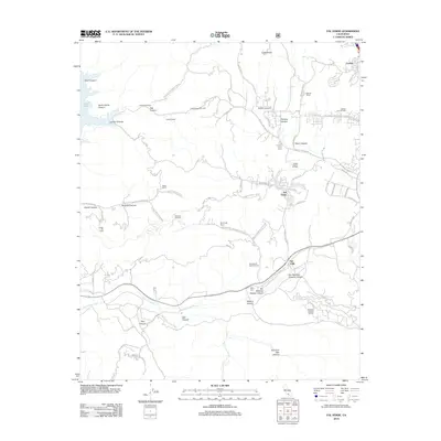
2012 Map of Val Verde
USGS Topo · Published 2012About this map
The Santa Clara River valley and its surrounding canyonlands define this landscape in the early 21st century, showing a mix of suburban growth and industrial energy production. The community of Val Verde and the settlement at Castaic anchor the eastern side of the map, while the western reaches remain dominated by topographical relief and named canyons like Santa Felicia Canyon and Lechler Canyon. This period illustrates the extent of petroleum extraction in the region, with the Del Valle Oil and Gas Field, Ramona Oil Field, and Holser Oil Field clearly marked across the hills. Local land ownership is evidenced by several named holdings, including Stanley Ranch, Hathaway Ranch, and Lechler Ranch. Significant infrastructure such as the Valle Training Center Rd and various fire roads like the Santa Felicia Canyon Fire Rd cut through the terrain, providing access to the higher elevations above Lake Piru.
Find a feature on this map
66 named features on this map. Tap any name to fly to it.
Don’t see what you’re looking for? This feature index may not catch every label — zoom into the map to look around manually.
Map Details
Editions of this 2012 Val Verde Map
This is the sole edition of this map. No revisions or reprints were ever made.
Other maps of this area

1900 · Piru
USGS Topo · 1:62,500

1903 · Tejon
USGS Topo · 1:125,000

1903 · Camulos
USGS Topo · 1:125,000

1903 · Santa Susana
USGS Topo · 1:62,500

1921 · Piru
USGS Topo · 1:62,500
1929 · Pico
USGS Topo · 1:24,000

1931 · Whitaker Peak
USGS Topo · 1:24,000

1931 · Santa Felicia Canyon
USGS Topo · 1:24,000

1931 · Castaic
USGS Topo · 1:24,000

1935 · Santa Felicia Canyon
USGS Topo · 1:24,000