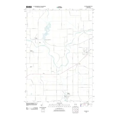
2010 Map of Valders
USGS Topo · Published 2010About this map
Collins Marsh 3 Reservoir dominates the northwestern portion of this Manitowoc County landscape, managed by the Collins Marsh 2WP1976 Dam along Mud Creek. This area of eastern Wisconsin preserves a distinct settlement pattern of small villages connected by a dense grid of rural roads like Old Irish Rd and Poplar Grove Rd. The village of Valders serves as a local hub, while the community of Saint Nazianz is situated to the south near the shores of Lake Oschwald.
Find a feature on this map
67 named features on this map. Tap any name to fly to it.
Don’t see what you’re looking for? This feature index may not catch every label — zoom into the map to look around manually.
Map Details
Editions of this 2010 Valders Map
This is the sole edition of this map. No revisions or reprints were ever made.
Other maps of this area

1954 · School Hill
USGS Topo · 1:24,000

1954 · St. Wendel
USGS Topo · 1:24,000

1954 · Howards Grove
USGS Topo · 1:62,500

1954 · Chilton
USGS Topo · 1:62,500

1954 · Reedsville
USGS Topo · 1:62,500

1954 · Kiel
USGS Topo · 1:62,500

1954 · Milwaukee
USGS Topo · 1:250,000

1954 · Manitowoc
USGS Topo · 1:250,000

1955 · Green Bay
USGS Topo · 1:250,000

1957 · Madison
USGS Topo · 1:250,000