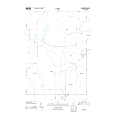
2013 Map of Valders
USGS Topo · Published 2013About this map
Valders serves as the primary hub in this central Manitowoc County landscape, characterized by the winding path of the Manitowoc River and a dense network of family-operated agricultural enterprises. The 2013 survey illustrates the continued importance of the dairy industry, with numerous named facilities such as Marsh Road Dairy, Cato Falls Dairy, and Badger Pride Dairy distributed across the countryside. To the west, the Collins Marsh Reservoir provides a significant hydrological feature near the settlement of Collins, while Saint Nazianz anchors the southern portion of the sheet near Lake Oschwald. The topography is marked by a prominent Quarry and specialized operations like the Hidden Acres Fur Farm, reflecting a diverse rural economy. Local transportation is facilitated by the Windhaven Airport and a grid of roads with distinctive names like N Humpty Dumpty Rd, providing a detailed look at the modern rural Wisconsin dairy belt.
Find a feature on this map
88 named features on this map. Tap any name to fly to it.
Don’t see what you’re looking for? This feature index may not catch every label — zoom into the map to look around manually.
Map Details
Editions of this 2013 Valders Map
This is the sole edition of this map. No revisions or reprints were ever made.
Other maps of this area

1954 · School Hill
USGS Topo · 1:24,000

1954 · St. Wendel
USGS Topo · 1:24,000

1954 · Howards Grove
USGS Topo · 1:62,500

1954 · Chilton
USGS Topo · 1:62,500

1954 · Reedsville
USGS Topo · 1:62,500

1954 · Kiel
USGS Topo · 1:62,500

1954 · Milwaukee
USGS Topo · 1:250,000

1954 · Manitowoc
USGS Topo · 1:250,000

1955 · Green Bay
USGS Topo · 1:250,000

1957 · Madison
USGS Topo · 1:250,000