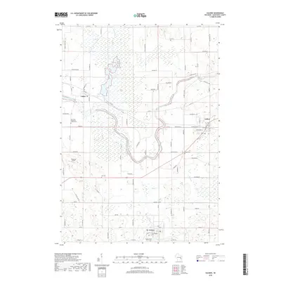
2018 Map of Valders
USGS Topo · Published 2018About this map
The Collins Marsh State Wildlife Area dominates the northwestern portion of this Manitowoc County landscape, where the Manitowoc River meanders toward the village of Collins. This survey highlights a rural environment defined by small-town centers and deep-rooted community sites. To the southeast, St. Nazianz is home to the Society of the Divine Savior Cem and Saint Gregory Cem, while the village of Valders serves as a hub near the Wisconsin Central railroad line. Historical researchers will find numerous burial grounds scattered across the townships, including the Tyler Cem and Saint Peter Evangelical Lutheran Cem. The terrain is shaped by water features like Lake Oschwald and Mud Creek, alongside landmarks such as Cato Falls and the Windhaven Airport.
Find a feature on this map
83 named features on this map. Tap any name to fly to it.
Don’t see what you’re looking for? This feature index may not catch every label — zoom into the map to look around manually.
Map Details
Editions of this 2018 Valders Map
This is the sole edition of this map. No revisions or reprints were ever made.
Other maps of this area

1954 · School Hill
USGS Topo · 1:24,000

1954 · St. Wendel
USGS Topo · 1:24,000

1954 · Howards Grove
USGS Topo · 1:62,500

1954 · Chilton
USGS Topo · 1:62,500

1954 · Reedsville
USGS Topo · 1:62,500

1954 · Kiel
USGS Topo · 1:62,500

1954 · Milwaukee
USGS Topo · 1:250,000

1954 · Manitowoc
USGS Topo · 1:250,000

1955 · Green Bay
USGS Topo · 1:250,000

1957 · Madison
USGS Topo · 1:250,000