2022 Map of Valders
USGS Topo · Published 2022About this map
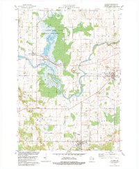
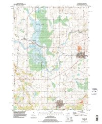
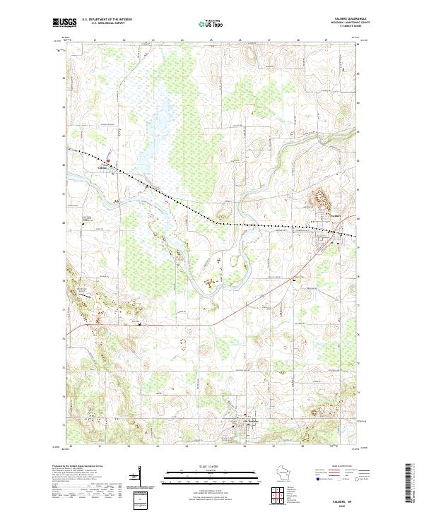
The Manitowoc River meanders through the heart of this East Central Wisconsin landscape, defining a terrain shaped by agricultural utility and small-town centers. The village of Valders serves as a primary hub on the eastern side, while St. Nazianz and Collins anchor the southern and western portions. The area is notable for its concentration of communal and religious history, evidenced by several significant burial sites including the Saint Gregory Cem and the Society of the Divine Savior Cem near Lake Oschwald. The drainage patterns of Mud Creek and the localized elevation change at Cato Falls illustrate the gradual descent of the land toward Lake Michigan. Tracing the network of roads like Old State 32 and Clarks Mills Rd reveals the persistent rural layout that has supported these dairy-country communities for generations.
Find a feature on this map
87 named features on this map. Tap any name to fly to it.
Don’t see what you’re looking for? This feature index may not catch every label — zoom into the map to look around manually.
Map Details
Editions of this 2022 Valders Map
This is the sole edition of this map. No revisions or reprints were ever made.
Historical Maps of Valders Through Time
3 maps found