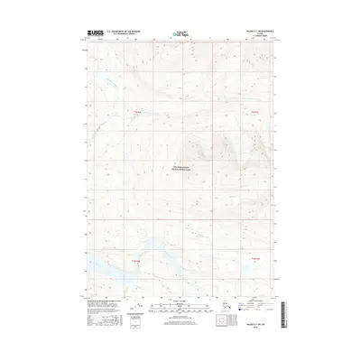
2016 Map of Valdez A-1 SW
USGS Topo · Published 2016About this map
Wrangell-Saint Elias National Park encompasses the high-altitude terrain shown in this digital-era survey, where glacial meltwater and complex drainage patterns carve through the mountain landscape. The hydrology is dominated by the Bremner River, which flows across the southern portion of the sheet, joined by smaller tributaries including Eagle Cr and Salmon Cr. Further north, the Little Bremner River and its various branches, such as the E Fork Little Bremner River, delineate the steep basins of the interior. This map is characterized by its lack of human infrastructure, focusing instead on the precise natural contours of the Alaskan wilderness and the vast, protected federal lands that define the Unorganized Borough in this region. The absence of roads or settlements emphasizes the remote nature of the Fork Little Bremner River drainage during the early twenty-first century.
Find a feature on this map
11 named features on this map. Tap any name to fly to it.
Don’t see what you’re looking for? This feature index may not catch every label — zoom into the map to look around manually.
Map Details
Editions of this 2016 Valdez A-1 SW Map
This is the sole edition of this map. No revisions or reprints were ever made.
Other maps of this area

1948 · Cordova
USGS Topo · 1:250,000

1951 · Cordova
USGS Topo · 1:250,000

1951 · Valdez A-1
USGS Topo · 1:63,360

1951 · Valdez A-2
USGS Topo · 1:63,360

1952 · Valdez
USGS Topo · 1:250,000
1957 · Valdez A-2
USGS Topo · 1:63,360

1959 · Cordova D-1
USGS Topo · 1:63,360

1959 · Cordova D-2
USGS Topo · 1:63,360

1959 · Cordova
USGS Topo · 1:250,000

1960 · Valdez
USGS Topo · 1:250,000