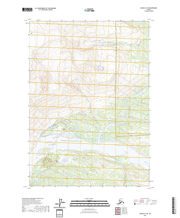
2023 Map of Valdez A-2 SE
USGS Topo · Published 2023About this map
The Bremner River system dominates this Alaskan landscape, where the braided waterways and glacial outflows carve through protected lands. Part of the Wrangell-Saint Elias National Park and the adjacent Wrangell-St. Elias Wilderness, the area showcases a complex hydrological network. Significant water features include Steamboat Lake and the elongated Harnell Slough, which lie in the wide valley floor south of the mountains. This 2023 survey documents the intersection of the Copper River County and Chugach County boundaries. Tributaries such as Porcupine Creek and MacCreel Creek feed into the larger river basins, illustrating the drainage patterns of this high-latitude wilderness. The map provides a detailed view of the Little Bremner River as it winds through the transition from high-elevation peaks to the river flats.
Find a feature on this map
14 named features on this map. Tap any name to fly to it.
Don’t see what you’re looking for? This feature index may not catch every label — zoom into the map to look around manually.
Map Details
Editions of this 2023 Valdez A-2 SE Map
This is the sole edition of this map. No revisions or reprints were ever made.
Other maps of this area

1948 · Cordova
USGS Topo · 1:250,000

1951 · Cordova
USGS Topo · 1:250,000

1951 · Valdez A-1
USGS Topo · 1:63,360

1951 · Valdez A-2
USGS Topo · 1:63,360

1952 · Valdez
USGS Topo · 1:250,000
1957 · Valdez A-2
USGS Topo · 1:63,360

1959 · Cordova D-1
USGS Topo · 1:63,360

1959 · Cordova D-2
USGS Topo · 1:63,360

1959 · Cordova
USGS Topo · 1:250,000

1960 · Valdez
USGS Topo · 1:250,000