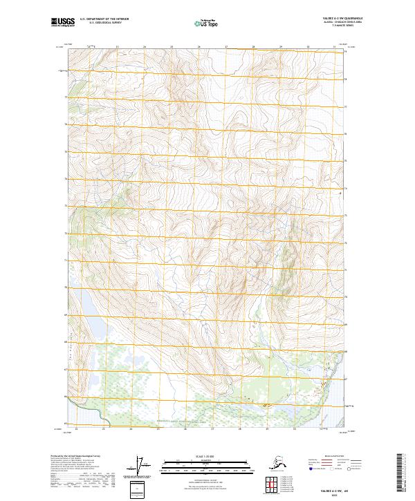
2023 Map of Valdez A-2 SW
USGS Topo · Published 2023About this map
The Bremner River drainage marks the southern reaches of this landscape, flowing along the edge of the Wrangell-Saint Elias National Park. Most of the mapped territory is defined by the high elevations of the Wrangell-St Elias Wilderness, a region where the land rises sharply from the river valley. A prominent topographic rise known as The Peninsula stands out as a distinct landform above the river's path, illustrating the drainage patterns that characterize this part of the Chugach Census Area. The grid lines of Township 9 South and Township 10 South intersect across the steep gradients, showing the administrative surveying of this wild terrain where the National Park and Wilderness boundaries meet.
Find a feature on this map
9 named features on this map. Tap any name to fly to it.
Don’t see what you’re looking for? This feature index may not catch every label — zoom into the map to look around manually.
Map Details
Editions of this 2023 Valdez A-2 SW Map
This is the sole edition of this map. No revisions or reprints were ever made.
Other maps of this area

1948 · Cordova
USGS Topo · 1:250,000

1950 · Valdez A-3
USGS Topo · 1:63,360

1950 · Cordova D-3
USGS Topo · 1:63,360

1951 · Cordova
USGS Topo · 1:250,000

1951 · Valdez A-2
USGS Topo · 1:63,360

1952 · Valdez
USGS Topo · 1:250,000

1953 · Cordova D-3
USGS Topo · 1:63,360

1953 · Valdez A-3
USGS Topo · 1:63,360
1957 · Valdez A-2
USGS Topo · 1:63,360

1959 · Cordova D-2
USGS Topo · 1:63,360