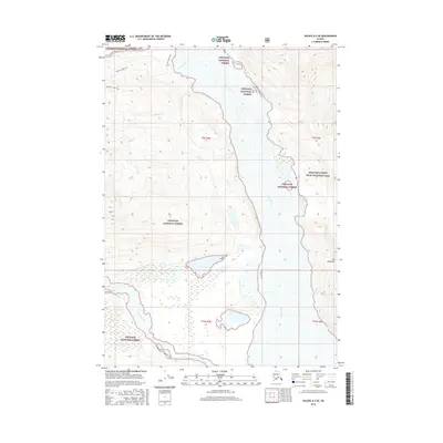
2016 Map of Valdez A-3 SE
USGS Topo · Published 2016About this map
The Copper River dominates this landscape, serving as a massive glacial drainage that snakes through the convergence of the Chugach National Forest and Wrangell-Saint Elias National Park. The topography is defined by the massive waterway and its tributaries, including the Tasnuna River and Clear Creek. A single human-named pathway, the Jackson Creek Trail, provides a thin line of access near Jackson Creek in the northwest, illustrating the isolation of this river-cut terrain. Further south, a distinctive landform known as The Peninsula sits within the complex wetland and river systems, highlighting the dynamic nature of this Alaskan waterway before it reaches the coast.
Find a feature on this map
13 named features on this map. Tap any name to fly to it.
Don’t see what you’re looking for? This feature index may not catch every label — zoom into the map to look around manually.
Map Details
Editions of this 2016 Valdez A-3 SE Map
This is the sole edition of this map. No revisions or reprints were ever made.
Other maps of this area

1948 · Cordova
USGS Topo · 1:250,000

1950 · Valdez A-3
USGS Topo · 1:63,360

1950 · Cordova D-3
USGS Topo · 1:63,360

1951 · Cordova
USGS Topo · 1:250,000

1951 · Valdez A-2
USGS Topo · 1:63,360

1952 · Valdez
USGS Topo · 1:250,000

1953 · Cordova D-3
USGS Topo · 1:63,360

1953 · Valdez A-3
USGS Topo · 1:63,360
1957 · Valdez A-2
USGS Topo · 1:63,360

1959 · Cordova D-2
USGS Topo · 1:63,360