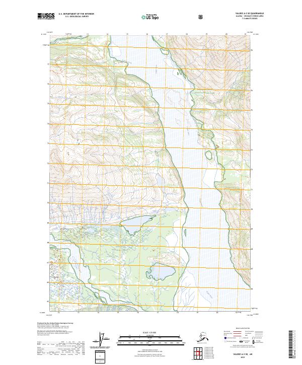
2023 Map of Valdez A-3 SE
USGS Topo · Published 2023About this map
The Copper River dominates this Alaskan landscape, carving a massive corridor between the high terrain of Wrangell-Saint Elias National Park and the Chugach National Forest. This modern survey illustrates the convergence of major glacial drainage systems, including the Tasnuna River and Jackson Creek. A narrow landform known as The Peninsula sits prominently within the river's path, highlighting the dynamic nature of the valley floor. Transportation in this wilderness is limited to foot travel along routes like the Jackson Creek Trl and Cleave Creek Trl, which follow the natural contours of the drainages. The map provides a contemporary look at the protected boundaries of the Wrangell-St. Elias Wilderness, where the scale of the environment remains largely untouched by industrial infrastructure.
Find a feature on this map
15 named features on this map. Tap any name to fly to it.
Don’t see what you’re looking for? This feature index may not catch every label — zoom into the map to look around manually.
Map Details
Editions of this 2023 Valdez A-3 SE Map
This is the sole edition of this map. No revisions or reprints were ever made.
Other maps of this area

1948 · Cordova
USGS Topo · 1:250,000

1950 · Valdez A-3
USGS Topo · 1:63,360

1950 · Cordova D-3
USGS Topo · 1:63,360

1951 · Cordova
USGS Topo · 1:250,000

1951 · Valdez A-2
USGS Topo · 1:63,360

1952 · Valdez
USGS Topo · 1:250,000

1953 · Cordova D-3
USGS Topo · 1:63,360

1953 · Valdez A-3
USGS Topo · 1:63,360
1957 · Valdez A-2
USGS Topo · 1:63,360

1959 · Cordova D-2
USGS Topo · 1:63,360