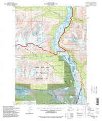
1994 Map of Valdez A-3
USGS Topo · Published 1998About this map
Copper River currents dominate this 1990s revision, carving a wide path through a landscape where federal land management boundaries converge. The area serves as a critical junction for the Wrangell-Saint Elias National Park and Wilderness and the Chugach National Forest, illustrating the complex preservation efforts in this part of Alaska. This survey reflects the region's character through its drainage patterns, showing how tributaries like Tiekel River and Tashnuna River feed into the primary river system.
Find a feature on this map
17 named features on this map. Tap any name to fly to it.
Don’t see what you’re looking for? This feature index may not catch every label — zoom into the map to look around manually.
Map Details
Editions of this 1994 Valdez A-3 Map
This is the sole edition of this map. No revisions or reprints were ever made.
Other maps of this area

1948 · Cordova
USGS Topo · 1:250,000

1950 · Valdez A-3
USGS Topo · 1:63,360

1950 · Cordova D-3
USGS Topo · 1:63,360

1951 · Cordova
USGS Topo · 1:250,000

1951 · Valdez B-2
USGS Topo · 1:63,360

1951 · Valdez B-3
USGS Topo · 1:63,360

1951 · Valdez B-4
USGS Topo · 1:63,360

1951 · Cordova D-4
USGS Topo · 1:63,360

1951 · Valdez A-2
USGS Topo · 1:63,360

1952 · Valdez
USGS Topo · 1:250,000