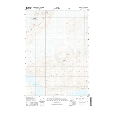
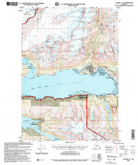
2016 Map of Valdez A-7 NW
USGS Topo · Published 2016About this map
Chugach National Forest dominates this coastal Alaska landscape, where the ice of the Columbia Glacier and Shoup Glacier meets the northern reaches of Prince William Sound. The terrain is defined by dramatic elevation changes, rising from the waters of Shoup Bay to the peaks of Mt Shasta and Mt Hogan. The map documents a complex hydrological network where glacial runoff feeds into several named drainages, including Gold Creek, Uno Creek, and Palmer Creek. Between these summits lies the Uno Basin, a distinct topographical bowl that illustrates the glacial carving characteristic of this region. This survey captures the wilderness in a transitional era of modern glacial retreat, providing a detailed record of the shoreline and ice margins as they appeared in the early 21st century.
Find a feature on this map
16 named features on this map. Tap any name to fly to it.
Don’t see what you’re looking for? This feature index may not catch every label — zoom into the map to look around manually.
Map Details
Editions of this 2016 Valdez A-7 NW Map
This is the sole edition of this map. No revisions or reprints were ever made.
Other maps of this area

1952 · Valdez
USGS Topo · 1:250,000

1960 · Valdez A-8
USGS Topo · 1:63,360

1960 · Valdez B-7
USGS Topo · 1:63,360

1960 · Valdez B-8
USGS Topo · 1:63,360

1960 · Valdez A-7
USGS Topo · 1:63,360

1960 · Valdez
USGS Topo · 1:250,000
1983 · Valdez A-7 SE
USGS Topo · 1:25,000
1983 · Valdez A-7 NE
USGS Topo · 1:25,000
1995 · Valdez A-8
USGS Topo · 1:63,360
1996 · Valdez A-7
USGS Topo · 1:63,360