
1960 Map of Valdez B-8
USGS Topo · Published 1965About this map
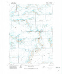
The vast frozen expanses of the Tazlina Glacier and Columbia Glacier dominate this 1960 field study, showcasing a landscape defined by movement and ice. Mapping of this high-altitude region was conducted by the U.S. Geological Survey using photogrammetric methods from aerial photographs taken in the mid-1950s. The resulting topography captures the intricate details of the terrain, specifically the numerous crevasses that mark the surface of the moving ice flows. In the northwest, the Nelchina Glacier flows between high ridges, illustrating the complex glacial network of the Chugach Mountains. This survey provides a primary record of glacial extent before the significant changes of the late 20th century, offering a specific baseline for glaciologists and historical geographers studying the Matanuska-Susitna region.
Find a feature on this map
4 named features on this map. Tap any name to fly to it.
Don’t see what you’re looking for? This feature index may not catch every label — zoom into the map to look around manually.
Map Details
Editions of this 1960 Valdez B-8 Map
2 editions found
Other maps of this area

1951 · Anchorage
USGS Topo · 1:250,000

1952 · Valdez
USGS Topo · 1:250,000

1960 · Valdez A-8
USGS Topo · 1:63,360

1960 · Anchorage A-1
USGS Topo · 1:63,360

1960 · Valdez B-7
USGS Topo · 1:63,360

1960 · Valdez C-7
USGS Topo · 1:63,360

1960 · Anchorage B-1
USGS Topo · 1:63,360

1960 · Valdez C-8
USGS Topo · 1:63,360

1960 · Valdez A-7
USGS Topo · 1:63,360

1960 · Anchorage C-1
USGS Topo · 1:63,360