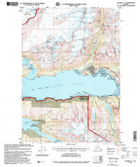
1996 Map of Valdez A-7
USGS Topo · Published 1999About this map
Port Valdez serves as the focal point of this coastal landscape, where the northern terminus of the Trans-Alaska Pipeline meets the waters of the Alaska Marine Highway. The map captures a critical period of transition, showing the relocation of the primary settlement following the 1964 earthquake; the original site is marked as Old Valdez while the current city of Valdez is established further west. The industrial and military history of the region is evident through the footprint of the Oil Terminal and the historical Fort Liscum (Site) near Jackson Point. Higher in the surrounding mountains, the legacy of early 20th-century resource extraction is preserved in labels for the Hercules Mine, Smith Mine, and Johnson Mill (Ruins). This map documents a landscape defined by both modern energy infrastructure and the physical remnants of Alaska's gold mining era.
Find a feature on this map
64 named features on this map. Tap any name to fly to it.
Don’t see what you’re looking for? This feature index may not catch every label — zoom into the map to look around manually.
Map Details
Editions of this 1996 Valdez A-7 Map
This is the sole edition of this map. No revisions or reprints were ever made.
Other maps of this area

1948 · Cordova
USGS Topo · 1:250,000

1950 · Cordova D-7
USGS Topo · 1:63,360

1951 · Cordova
USGS Topo · 1:250,000

1951 · Cordova D-8
USGS Topo · 1:63,360

1951 · Cordova D-6
USGS Topo · 1:63,360

1951 · Valdez B-6
USGS Topo · 1:63,360

1951 · Valdez A-6
USGS Topo · 1:63,360

1952 · Valdez
USGS Topo · 1:250,000

1952 · Cordova D-8
USGS Topo · 1:63,360

1952 · Cordova D-7
USGS Topo · 1:63,360