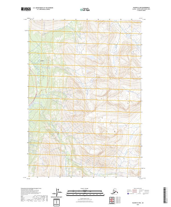
2023 Map of Valdez B-3 NW
USGS Topo · Published 2023About this map
The settlement of Tonsina serves as a focal point in this high-altitude Alaskan landscape, where modern transportation corridors intersect with ancient natural drainages. The Richardson Highway parallels the course of the Tiekel River and the Little Tonsina River, following the path of least resistance through a complex network of glacial valleys and steep divides. The geography is defined by a dense web of hydrological features, including the Ernestine Creek, Mosquito Creek, and the eastward-flowing Uranatina River.
Find a feature on this map
15 named features on this map. Tap any name to fly to it.
Don’t see what you’re looking for? This feature index may not catch every label — zoom into the map to look around manually.
Map Details
Editions of this 2023 Valdez B-3 NW Map
This is the sole edition of this map. No revisions or reprints were ever made.
Other maps of this area

1951 · Valdez B-3
USGS Topo · 1:63,360

1951 · Valdez C-3
USGS Topo · 1:63,360

1951 · Valdez C-4
USGS Topo · 1:63,360

1951 · Valdez B-4
USGS Topo · 1:63,360

1952 · Valdez
USGS Topo · 1:250,000

1953 · Valdez C-3
USGS Topo · 1:63,360

1953 · Valdez B-4
USGS Topo · 1:63,360

1953 · Valdez C-4
USGS Topo · 1:63,360

1960 · Valdez
USGS Topo · 1:250,000

1994 · Valdez B-4
USGS Topo · 1:63,360