
1953 Map of Valdez B-4
USGS Topo · Published 1954About this map
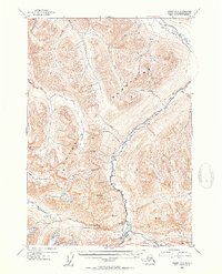
The Chugach Mountains dominate this 1953 landscape, where the Richardson Highway provides the primary corridor for movement through the high-elevation terrain. This survey captures a specific moment in the mid-century development of Alaska's interior road system, following the Tiekel River as it winds through deep valleys. Settlement is sparse and focused entirely on the road and river network, evidenced by the presence of Tiekel Cache and the small station at Tiekel. Steep topographical gradients define the area, rising sharply from the riverbanks to prominent peaks like Mt Tiekel and Rice Mtn. Numerous glacial-fed tributaries, including Stuart Creek, Hurtle Creek, and Boulder Creek, drain into the main river systems, illustrating the complex hydrology of this subarctic environment before further modern infrastructure expanded into these basins.
Find a feature on this map
18 named features on this map. Tap any name to fly to it.
Don’t see what you’re looking for? This feature index may not catch every label — zoom into the map to look around manually.
Map Details
Editions of this 1953 Valdez B-4 Map
2 editions found
Other maps of this area

1950 · Valdez A-3
USGS Topo · 1:63,360

1951 · Valdez B-3
USGS Topo · 1:63,360

1951 · Valdez B-5
USGS Topo · 1:63,360

1951 · Valdez C-3
USGS Topo · 1:63,360

1951 · Valdez C-4
USGS Topo · 1:63,360

1951 · Valdez B-4
USGS Topo · 1:63,360

1951 · Valdez C-5
USGS Topo · 1:63,360

1952 · Valdez
USGS Topo · 1:250,000

1953 · Valdez C-3
USGS Topo · 1:63,360

1953 · Valdez C-5
USGS Topo · 1:63,360