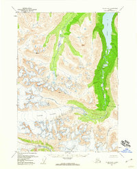
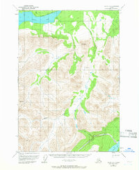
1951 Map of Valdez B-5
USGS Topo · Published 1960About this map
Tonsina Glacier dominates the central portion of this 1950s landscape, illustrating the raw hydrological systems of the Alaska interior. The meltwater from this massive ice field feeds the Tonsina River, which flows into the expansive Tonsina Lake to the north. This survey, compiled from aerial photography taken in 1950 and 1957, documents a wilderness devoid of roads or trails, where natural drainage patterns define the geography. The presence of Greyling Lake and its corresponding Greyling Creek suggests a sub-basin tucked between the high peaks, while the Tsina River skirts the southern margin. The map provides a baseline for geomorphological change, recording the exact extent of the glacial ice and the braided channels of the river valleys before more modern climactic shifts altered these features.
Find a feature on this map
10 named features on this map. Tap any name to fly to it.
Don’t see what you’re looking for? This feature index may not catch every label — zoom into the map to look around manually.
Map Details
Editions of this 1951 Valdez B-5 Map
2 editions found

Other maps of this area
1950 · Valdez C-6
USGS Topo · 1:63,360
1951 · Valdez C-4
USGS Topo · 1:63,360
1951 · Valdez B-4
USGS Topo · 1:63,360
1951 · Valdez C-5
USGS Topo · 1:63,360
1951 · Valdez B-6
USGS Topo · 1:63,360

1951 · Valdez A-6
USGS Topo · 1:63,360

1952 · Valdez
USGS Topo · 1:250,000
1952 · Valdez A-6
USGS Topo · 1:63,360

1953 · Valdez C-6
USGS Topo · 1:63,360

1953 · Valdez B-4
USGS Topo · 1:63,360