
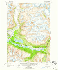
1952 Map of Valdez A-6
USGS Topo · Published 1955About this map
Glacial movement and river dynamics define the terrain surrounding the Lowe River valley in the early 1950s. The Valdez Glacier dominates the northern landscape, its retreat recorded in the vast fields of crevasses and the formation of the Robe River drainage system. Along the valley floor, the Richardson Highway provides the primary overland artery, passing through the sheer walls of Keystone Canyon where a tunnel was required for passage. Near the coast, the aviation infrastructure is well-established, featuring both the Valdez Airport and a designated Seaplane Landing on Robe Lake. Small cabins and a Cem are situated near the junction of mountain streams, indicating the scattered nature of settlement during this period of geological and topographic surveying.
Find a feature on this map
39 named features on this map. Tap any name to fly to it.
Don’t see what you’re looking for? This feature index may not catch every label — zoom into the map to look around manually.
Map Details
Editions of this 1952 Valdez A-6 Map
2 editions found
Other maps of this area

1948 · Cordova
USGS Topo · 1:250,000

1950 · Cordova D-7
USGS Topo · 1:63,360

1950 · Cordova D-5
USGS Topo · 1:63,360

1951 · Cordova
USGS Topo · 1:250,000

1951 · Valdez B-5
USGS Topo · 1:63,360

1951 · Cordova D-6
USGS Topo · 1:63,360

1951 · Valdez B-6
USGS Topo · 1:63,360

1951 · Valdez A-6
USGS Topo · 1:63,360

1952 · Valdez
USGS Topo · 1:250,000

1952 · Cordova D-7
USGS Topo · 1:63,360