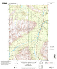
1996 Map of Valdez C-4
USGS Topo · Published 2001About this map
Tonsina and the tiny settlement of Kimball occupy a strategic corridor in the Copper River basin, where the Trans-Alaska Pipeline and the Richardson Highway run parallel through the glacial river valleys. The landscape is defined by the braided path of the Tonsina River and its major tributaries, including the Little Tonsina River and Bernard Creek. To the west, the high country is anchored by Mt DuRelle, while the valley floors contain critical infrastructure for the region, such as a Landing Strip and a Gaging Station.
Find a feature on this map
24 named features on this map. Tap any name to fly to it.
Don’t see what you’re looking for? This feature index may not catch every label — zoom into the map to look around manually.
Map Details
Editions of this 1996 Valdez C-4 Map
This is the sole edition of this map. No revisions or reprints were ever made.
Other maps of this area

1948 · Valdez D-5
USGS Topo · 1:63,360

1949 · Valdez D-4
USGS Topo · 1:63,360

1951 · Valdez D-5
USGS Topo · 1:63,360

1951 · Valdez B-3
USGS Topo · 1:63,360

1951 · Valdez B-5
USGS Topo · 1:63,360

1951 · Valdez C-3
USGS Topo · 1:63,360

1951 · Valdez C-4
USGS Topo · 1:63,360

1951 · Valdez B-4
USGS Topo · 1:63,360

1951 · Valdez C-5
USGS Topo · 1:63,360

1952 · Valdez
USGS Topo · 1:250,000