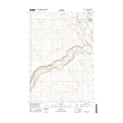
2016 Map of Valdez D-4 NW
USGS Topo · Published 2016About this map
Copper Center and the neighboring settlement of Silver Springs occupy the northeast corner of this Alaskan interior landscape, situated near the confluence of the Klutina River and the Copper River. The region is defined by critical infrastructure and protected lands, with the Wrangell-Saint Elias National Preserve bordering the eastern edge of the map. Modern energy and transit routes dominate the terrain, notably the Alaska Pipeline and the Richardson Highway, which cut through the landscape alongside local arteries like Hector Ewan Road and Brenwick-Craig Road. The western portion of the map is characterized by more isolated terrain drained by Yetna Cr, showcasing the typical transition from highway-side development to the undisturbed wilderness of the unorganized borough.
Find a feature on this map
15 named features on this map. Tap any name to fly to it.
Don’t see what you’re looking for? This feature index may not catch every label — zoom into the map to look around manually.
Map Details
Editions of this 2016 Valdez D-4 NW Map
This is the sole edition of this map. No revisions or reprints were ever made.
Other maps of this area

1948 · Valdez D-5
USGS Topo · 1:63,360

1949 · Gulkana A-3
USGS Topo · 1:63,360

1949 · Valdez D-4
USGS Topo · 1:63,360

1951 · Valdez D-5
USGS Topo · 1:63,360

1951 · Gulkana
USGS Topo · 1:250,000

1951 · Gulkana A-4
USGS Topo · 1:63,360

1952 · Gulkana A-3
USGS Topo · 1:63,360

1952 · Valdez
USGS Topo · 1:250,000

1952 · Valdez D-4
USGS Topo · 1:63,360

1952 · Gulkana A-4
USGS Topo · 1:63,360